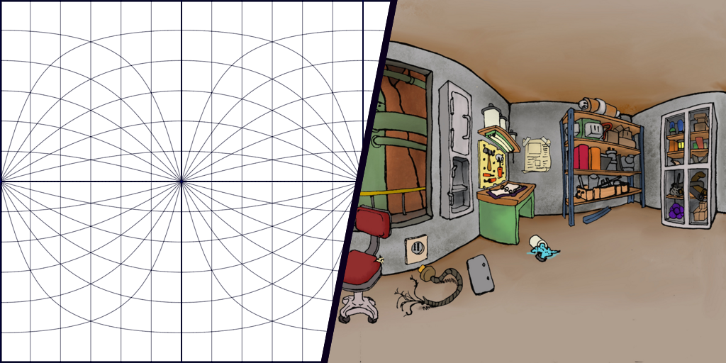
I recently fell into a bit of a rabbit hole with equirectangular projections. They’re a way of mapping the surface of a sphere onto a single image. That can mean unwrapping a ball-like object like the Earth to make a map, but can also be a way to map 360 degrees of an environment to a single image that’s much more readable than say six separate images (as in cube maps).
A side effect of the equirectangular projection being easy to understand is that you can use it to hand-draw virtual spaces. It’s a little tricky to get the hang of though, so having a nice guide definitely helps. To that end, I’ve made a tool using JS that generates an equirectangular grid in a light blue, suitable for printing out and drawing on top of.
See it for yourself here. Right-click on the image to save it, or download one of the PDF versions.
 Follow
